2 books by Lawson, Russell M.

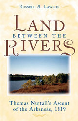
The Land between the Rivers
Thomas Nuttall's Ascent of the Arkansas, 1819
Russell M. Lawson
University of Michigan Press, 2004
An adventure story from the wilds of early America, The Land between the Rivers recreates the journeys of the English botanist Thomas Nuttall, one of American history's most well-traveled scientists.
During the early nineteenth century, Nuttall explored the waters, valleys, plains, and mountains of the Great Lakes, Ohio River, Mississippi River, as well as the Missouri, Arkansas, Red, and Canadian river valleys of the former Louisiana Territory.
In this fascinating account of Nuttall's travels through the wilderness of the middle west, author Russell Lawson-using Nuttall's own journal-captures the sense of excitement of the early wanderer. As much a delight for the mind as the senses, The Land between the Rivers details the unremitting weather and rugged geography of uncharted lands within the Louisiana Territory. A sense of discovery pervades the narrative as Nuttall's odyssey builds to its climax in the prairie wilderness of what is now Oklahoma. Sickened by "ague"-in his case, malaria-Nuttall at times was barely able to go on; yet he continued to search for and catalog plants and animals.
The Land between the Rivers expands our knowledge of the work of one of the country's earliest botanists. We also learn a great deal about the early explorers, the inhabitants of the unsettled land, and about the land and culture of the times.
[more]

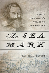
The Sea Mark
Captain John Smith’s Voyage to New England
Russell M. Lawson
University Press of New England, 2015
By age thirty-four Captain John Smith was already a well-known adventurer and explorer. He had fought as a mercenary in the religious wars of Europe and had won renown for fighting the Turks. He was most famous as the leader of the Virginia Colony at Jamestown, where he had wrangled with the powerful Powhatan and secured the help of Pocahontas. By 1614 he was seeking new adventures. He found them on the 7,000 miles of jagged coastline of what was variously called Norumbega, North Virginia, or Cannada, but which Smith named New England. This land had been previously explored by the English, but while they had made observations and maps and interacted with the native inhabitants, Smith found that “the Coast is . . . even as a Coast unknowne and undiscovered.” The maps of the region, such as they were, were inaccurate. On a long, painstaking excursion along the coast in a shallop, accompanied by sailors and the Indian guide Squanto, Smith took careful compass readings and made ocean soundings. His Description of New England, published in 1616, which included a detailed map, became the standard for many years, the one used by such subsequent voyagers as the Pilgrims when they came to Plymouth in 1620. The Sea Mark is the first narrative history of Smith’s voyage of exploration, and it recounts Smith’s last years when, desperate to return to New England to start a commercial fishery, he languished in Britain, unable to persuade his backers to exploit the bounty he had seen there.
[more]
READERS
Browse our collection.
PUBLISHERS
See BiblioVault's publisher services.
STUDENT SERVICES
Files for college accessibility offices.
UChicago Accessibility Resources
home | accessibility | search | about | contact us
BiblioVault ® 2001 - 2024
The University of Chicago Press


